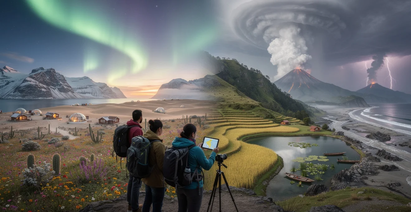
The planet’s most extraordinary natural phenomena unfold according to precise seasonal rhythms, creating fleeting windows of breathtaking beauty that exist for mere days or weeks each year. These ephemeral spectacles—from the dancing aurora borealis across Arctic skies to the synchronised blooming of desert wildflowers—represent some of nature’s most exclusive performances. Timing your travels to witness these rare seasonal landscapes requires meticulous planning, deep understanding of natural cycles, and often, a willingness to venture into remote corners of the world. Yet the rewards are immeasurable: experiencing landscapes in their most dramatic transformations offers perspectives that few travellers ever witness.
The increasing accessibility of detailed meteorological data, coupled with local knowledge networks and real-time monitoring systems, has revolutionised how adventurous travellers can position themselves to witness these natural marvels. However, the unpredictable nature of many seasonal phenomena means that success often depends on flexibility, preparation, and understanding the complex interplay of factors that create these spectacular displays.
Optimal timing strategies for witnessing ephemeral natural phenomena
Successfully capturing nature’s rarest seasonal displays demands a sophisticated approach that extends far beyond simply checking average weather patterns. The most experienced landscape photographers and nature enthusiasts employ multi-layered timing strategies that account for cyclical patterns, environmental triggers, and location-specific variables that influence when and where these phenomena occur.
Phenological calendar planning for peak seasonal transitions
Phenology—the study of seasonal biological cycles—provides the foundation for predicting when specific natural events will occur. Rather than relying on calendar dates, phenological timing responds to cumulative environmental conditions such as temperature accumulation, daylight duration, and precipitation patterns. For instance, cherry blossoms in Japan don’t bloom on a fixed date but rather when accumulated warmth reaches specific thresholds, which can vary by several weeks between years.
Creating a personalised phenological calendar involves tracking historical data for your target phenomena across multiple years. Professional nature photographers often maintain detailed records spanning decades, noting not just peak dates but also the duration of optimal viewing windows. This approach proves particularly valuable for phenomena like autumn foliage, where peak colours might persist for only 3-5 days in specific locations, yet the timing can shift by up to three weeks depending on weather patterns in the preceding months.
Weather pattern analysis and microclimate considerations
Understanding regional weather patterns and their relationship to seasonal phenomena enables more precise timing predictions. Many spectacular natural displays result from specific meteorological conditions converging at particular moments. For example, the formation of dramatic ice caves requires sustained sub-zero temperatures followed by specific warming patterns that create the translucent blue ice formations that photographers prize.
Microclimate analysis becomes crucial when targeting location-specific phenomena. Valley systems, coastal interfaces, and elevation changes can create conditions that differ dramatically from regional averages. The famous morning mist photography opportunities in locations like Myanmar’s temples or Tuscany’s rolling hills depend on temperature inversions that occur only when specific atmospheric conditions align with local topography.
Astronomical event coordination with landscape photography
Many of the world’s most sought-after seasonal landscapes combine terrestrial phenomena with astronomical events, creating compositions that transcend ordinary nature photography. Coordinating these elements requires understanding both the predictable nature of astronomical cycles and the variable timing of natural seasonal changes.
The intersection of aurora activity with landscape features exemplifies this complexity. While aurora forecasting has improved dramatically through satellite monitoring and solar wind prediction models, successful aurora landscape photography depends on clear skies, minimal light pollution, and foreground elements that complement the celestial display. Advanced planning tools now allow photographers to identify specific locations where auroras will align with dramatic landscape features during optimal viewing windows.
Local knowledge networks and indigenous seasonal indicators
Indigenous communities and long-term local residents possess invaluable knowledge about subtle seasonal indicators that scientific monitoring systems often miss. These traditional ecological knowledge systems recognise patterns in animal behaviour, plant responses, and atmospheric conditions that can predict natural phenomena with remarkable accuracy.
Developing relationships with local guides and indigenous knowledge keepers provides access to timing information that external visitors cannot obtain through conventional research. For instance, traditional fishermen in northern Norway can predict aurora activity through subtle changes in wildlife behaviour
and shifts in the clarity of the night sky long before satellite data suggests heightened solar activity. Similarly, herders in Mongolia or reindeer communities in Sápmi observe animal migration routes and grazing patterns that hint at changes in snowpack, ice safety, and the onset of spring thaw. When you combine these qualitative insights with quantitative tools such as satellite imagery and climate databases, your seasonal travel planning becomes far more robust and responsive to real-world conditions.
Arctic and Sub-Arctic seasonal spectacles: aurora borealis viewing locations
For many travellers, witnessing the aurora borealis in peak season is the pinnacle of seasonal landscape travel. The auroral oval arcs across Arctic and Sub-Arctic latitudes, but not all locations offer equal chances of clear skies, stable weather, and accessible infrastructure. Choosing where to base yourself is as important as picking the right month, and the best aurora destinations balance high geomagnetic activity with dark winter nights, minimal light pollution, and diverse foreground landscapes.
Tromsø and lofoten islands: northern norway’s aurora corridors
Tromsø sits almost directly beneath the auroral oval, making it one of the world’s most reliable hubs for Northern Lights travel between late September and early April. The Gulf Stream moderates temperatures, so while you still need winter gear, conditions are often milder than comparable latitudes in Canada or Siberia. The city offers aurora tours, fjord cruises, and quick access to darker coastal and inland areas, giving you flexibility to chase clear skies when cloud cover moves in.
Further southwest, the Lofoten Islands combine aurora activity with dramatic mountain peaks, fishing villages, and white-sand Arctic beaches that glow under winter moonlight. Here, the interplay of changing seasons and coastal weather is crucial: autumn (October–November) can bring more storms but also atmospheric drama, while deep winter (January–February) often offers longer, more stable nights. For optimal aurora travel photography, plan for at least three to five nights in the region, hire a car to escape local cloud banks, and use aurora forecast tools that integrate KP index, cloud cover, and solar wind data.
Iceland’s westfjords and jökulsárlón glacier lagoon winter phenomena
While Iceland is a year-round travel destination, its rarest seasonal landscapes emerge during the long nights from October to March, when the Northern Lights frequently ripple above volcanic terrain and glacial lagoons. Beyond the popular Golden Circle, the remote Westfjords deliver some of the darkest skies in Europe, with rugged fjord scenery and minimal light pollution. Reaching them in winter requires careful planning around snow, ice, and road closures, but the reward is a sense of near-total solitude beneath active auroral displays.
On the south coast, Jökulsárlón Glacier Lagoon and the adjacent Diamond Beach transform into an otherworldly stage for winter photography. Icebergs calved from Breiðamerkurjökull drift through the lagoon before washing up on black sand beaches, where they catch aurora light like prisms. Optimal timing hinges on three intersecting factors: strong auroral activity, clear skies, and safe road conditions along the Ring Road. Building buffer days into your itinerary allows you to wait out storms and position yourself when a clear, cold night coincides with both lunar phases and peak aurora forecasts.
Canadian yukon territory and whitehorse aurora forecasting
In Canada’s Yukon Territory, the capital Whitehorse and nearby wilderness lodges form a strategic base for winter and shoulder-season aurora watching. From late August through April, long nights and continental air masses create excellent conditions, with autumn and early spring offering milder temperatures than mid-winter. Unlike coastal locations, the Yukon’s drier climate often means clearer skies, which can dramatically increase your chances of seeing the Northern Lights over a short trip.
Advanced aurora travel planning here involves combining real-time geomagnetic data from organizations such as NOAA with regional weather models and local expertise. Many Yukon operators run aurora-viewing lodges outside Whitehorse with heated viewing huts, foreground elements like frozen lakes and spruce forests, and minimal light pollution. If you’re serious about night photography, consider planning around new moons to maximise contrast, and always factor in the extreme cold: camera batteries drain faster, and safe travel requires appropriate clothing and contingency plans.
Finnish lapland’s kakslauttanen and glass igloo experiences
Finnish Lapland offers one of the most curated seasonal travel experiences for aurora seekers, especially around destinations such as Kakslauttanen. From late August to April, the sky frequently comes alive, and the region has turned its advantageous latitude into an entire ecosystem of aurora-focused accommodation: glass igloos, panoramic cabins, and heated domes that allow you to watch the night sky without stepping into sub-zero temperatures. This combination of comfort and spectacle makes Lapland particularly appealing for travellers who want a balance between rugged nature and well-developed infrastructure.
Choosing the right moment within the aurora season depends on your priorities. Early autumn brings unfrozen lakes and golden birch forests, offering reflections and rich foreground colours, while mid-winter delivers deep snow, reindeer sledding, and ice hotels. By March and early April, longer days enable cross-country skiing and snowshoeing, yet nights are still dark enough for auroral activity. Because Lapland is popular, early booking is essential for glass igloos during peak dates; for a more flexible seasonal landscape trip, you might combine a few nights in iconic accommodation with additional nights in simpler cabins away from the main resorts.
Desert bloom cycles and rare flowering events across global arid regions
Desert landscapes often appear static and lifeless, but under the right seasonal conditions they can erupt into brief, spectacular blooms. These desert flower events are among the most elusive seasonal travel experiences because they depend on very specific rainfall patterns, temperature ranges, and soil moisture levels. Some occur only once every several years, turning normally monochrome plains into carpets of colour that last a few weeks—or sometimes mere days—before fading back into dormancy.
Planning a trip around a desert super bloom is a bit like trying to hit a moving target: historical data can show you windows of likelihood, but real-time precipitation and bloom reports ultimately determine success. Regions such as California’s Anza-Borrego Desert, Chile’s Atacama Desert, and Western Australia’s wildflower corridors are classic examples of destinations where seasonal rainfall anomalies trigger rare flowering events. To maximise your chances, monitor local park bulletins, citizen-science platforms, and wildflower hotlines, and be prepared to pivot your travel dates or routes at short notice when conditions align.
Monsoon-dependent landscapes: timing india’s western ghats and southeast asian valleys
Monsoon systems shape some of the planet’s most dramatic seasonal landscapes, transforming parched hillsides into emerald mosaics and filling rice terraces, waterfalls, and wetlands. Travelling with the monsoon requires a more nuanced approach than simply avoiding rain: in many regions, the days and weeks just after peak precipitation reveal the most photogenic combinations of lush vegetation, flowing rivers, and mist-filled valleys. When timed correctly, a monsoon-focused itinerary can be one of the most rewarding seasonal travel experiences you undertake.
Because monsoon onset and withdrawal dates can vary significantly from year to year, smart planning blends long-term climatological averages with the current season’s rainfall data and local reports. It’s often useful to treat monsoon landscapes in phases: early monsoon for dramatic stormscapes and rising water levels, mid-monsoon for fullest rivers and most intense greens, and post-monsoon for clearer skies combined with saturated landscapes. The following destinations in India and Southeast Asia exemplify how precise timing within the monsoon cycle can radically change what you see and photograph.
Kerala’s neelakurinji blooms in munnar’s high altitude grasslands
One of the most extraordinary seasonal events in the Western Ghats is the mass flowering of Neelakurinji (Strobilanthes kunthiana), a shrub that carpets the hillsides of Munnar’s high-altitude grasslands in shades of violet-blue. This bloom occurs roughly once every 12 years, with the last major event peaking around 2018, making it as much a generational event as a seasonal one. During these rare months, normally green slopes transform into surreal colour fields, drawing travellers, botanists, and photographers from around the world.
Because the Neelakurinji bloom is both cyclical and sensitive to local microclimates, it doesn’t peak everywhere at the same time. Some slopes may reach full colour several weeks before others, depending on elevation, sun exposure, and rainfall history. If you plan to travel for this event, treat official tourism board announcements as a starting point, then consult regional forest departments, hiking guides, and local homestays for real-time updates on which trails are at peak flowering. Combining the Neelakurinji spectacle with the tail end of the Southwest Monsoon also gives you a chance to photograph rolling mists, waterfalls, and tea plantations in their greenest state.
Myanmar’s inle lake floating gardens during peak monsoon
Inle Lake in Myanmar is a living example of how monsoon rhythms shape both landscape and culture. The lake’s famed floating gardens—constructed from layers of vegetation and soil anchored by bamboo poles—expand and thrive during the rainy season, when water levels rise and nutrient-rich inflows feed the crops. From roughly June to October, the lake swells, villages adjust to higher waters, and the entire basin takes on a lush, saturated appearance that contrasts sharply with the drier winter months.
Travelling to Inle during peak monsoon requires accepting rain as a central element of the experience rather than an inconvenience. The reward is a landscape alive with reflections, low-lying clouds hugging the surrounding Shan hills, and farmers navigating narrow canals between floating beds of tomatoes, gourds, and flowers. Boat trips at dawn and late afternoon provide the best light for photography, especially when passing traditional stilt houses and monasteries half-shrouded in mist. For safety and comfort, choose locally operated boats, pack waterproof covers for your camera gear, and build in extra days to accommodate weather-related disruptions.
Vietnam’s sapa rice terraces golden harvest photography
The terraced rice fields around Sapa in northern Vietnam offer a textbook example of how agricultural calendars dictate peak seasonal landscapes. While the terraces are scenic year-round, their most spectacular phase coincides with the golden harvest season, when ripening rice turns the hillsides into layered waves of yellow and amber. This window typically falls between late September and early October, but exact timing varies with altitude, planting schedules, and monsoon intensity.
For photography-focused travel, you’ll want to time your visit not only for colour but also for atmospheric conditions. Early mornings often bring fog that lifts to reveal terraces in soft, diffused light, while late afternoons can produce dramatic skies as weather fronts move through the mountains. Working with local Hmong or Dao guides allows you to pinpoint which valleys—such as Muong Hoa or nearby Y Ty—are at peak colour during your stay. Because harvest can begin quickly once fields are ready, flexibility is critical: you may need to adjust your hiking plans day by day to follow the unfolding golden wave across different elevations.
Thailand’s mae hong son loop sunflower field seasons
In northern Thailand, the Mae Hong Son Loop combines winding mountain roads, misty valleys, and seasonal floral displays that reward travellers who venture beyond peak tourist months. One of the region’s most photogenic phenomena is the blooming of Mexican sunflowers (Tithonia diversifolia) around Doi Mae U Kho, usually from November to early December. For a few short weeks, hillsides erupt into dense carpets of bright yellow blooms, contrasting with deep green pine forests and blue autumn skies.
Because this sunflower season coincides with the cool, dry months following the monsoon, it’s an ideal time for road trips and motorcycle loops. Mornings can be crisp and foggy, creating layered vistas from viewpoints along Highway 108 and 1095, while midday offers clear visibility for panoramic shots of the sunflower fields. To avoid weekend crowds, aim for mid-week visits and sunrise arrivals at the main viewing areas. Combine the floral spectacle with side trips to hill-tribe villages, caves, and waterfalls that still carry the freshness of the recently ended rainy season.
Migration-synchronized natural events and wildlife corridor landscapes
Some of the most powerful seasonal travel experiences revolve around animal migrations and the shifting landscapes that support them. These wildlife events are tightly linked to rainfall patterns, grass growth, river levels, and temperature changes, turning whole regions into dynamic corridors of movement. Unlike fixed-date festivals, migrations are responsive: they may arrive early, stall, or reroute depending on ecological conditions, which means that travellers must approach them with both research and flexibility.
Classic examples include East Africa’s Great Wildebeest Migration, the mass movement of caribou across Arctic tundra, monarch butterflies clustering in Mexico’s highland forests, and bird migrations along flyways such as the East Atlantic or East Asian–Australasian routes. In each case, the surrounding landscapes—savannah grasslands, boreal forests, wetlands—undergo their own seasonal transitions that shape the visual and ecological context of the migration. Responsible planning here means not only timing your visit for peak wildlife activity but also choosing operators and routes that minimise disturbance, respect local communities, and contribute to long-term conservation.
Advanced planning methodologies for rare geological and meteorological events
Beyond predictable seasonal changes, some of the planet’s most compelling spectacles are tied to rare or short-lived geological and meteorological events. Capturing an active lava flow, a towering supercell thunderstorm, or a coastline laid bare by an extreme low tide demands both technical knowledge and a rigorous approach to safety. In many ways, planning for these phenomena is similar to preparing for a complex expedition: you must balance detailed forecasting and modelling with on-the-ground decision-making and clear risk thresholds.
Because these events can be dangerous or disruptive for local communities, ethical considerations are paramount. Storm-chasing in Tornado Alley, for example, requires strict adherence to safety protocols and respect for private property and emergency services. Similarly, photographing lava flows or volatile geothermal features demands that you follow local regulations and scientific guidance. When executed responsibly, however, journeys built around rare geological and meteorological events can provide unparalleled insight into Earth’s dynamic systems and yield once-in-a-lifetime images.
Volcanic activity monitoring for safe lava flow photography
Volcanic landscapes are inherently seasonal in their own way, cycling between periods of dormancy, mild degassing, and full-scale eruptions that can alter entire regions. For travellers and photographers, the goal is to experience active volcanic features—lava flows, glowing craters, fumaroles—without exposing themselves or others to unnecessary risk. This starts with understanding that volcanic activity is monitored in real time by geological surveys, observatories, and satellite systems that provide alert levels and hazard maps.
Before planning a trip around active volcanoes such as Kīlauea in Hawaii, Etna in Italy, or Fagradalsfjall in Iceland, consult the latest updates from official agencies rather than relying on social media posts. These sources detail not only current activity but also access restrictions, gas hazards, and changing lava flow paths. On location, always join guided tours run in coordination with local authorities, and follow established trails even if they seem less photogenic. Think of volcanic photography like approaching a wild animal: you want proximity and drama, but only from a distance and angle that keeps you safely out of harm’s way.
Storm chasing protocols for supercell and tornado alley documentation
Storm chasing in regions such as the US Great Plains has evolved from an informal pursuit into a highly specialised form of seasonal travel. The core season, typically from April to June, sees warm, moist air from the Gulf of Mexico collide with cooler, drier air masses, creating conditions ripe for supercells and tornadoes. For photographers and weather enthusiasts, capturing these towering storm structures—complete with rotating updrafts, lightning, and dramatic cloud formations—can be the ultimate meteorological challenge.
Yet storm chasing is not a casual activity; it requires a strong respect for forecasting science and strict safety protocols. Professional chasers use numerical weather models, Doppler radar data, and mesoscale discussions to identify promising target areas each day. When you join a reputable storm-chasing tour, you gain access to this expertise along with experienced drivers who understand escape routes, road networks, and local shelter options. As with any high-risk seasonal landscape experience, the goal is to position yourself where you can view and photograph storms from safe distances, never prioritising an image over your safety or that of nearby communities.
Tidal bore predictions and extreme low tide coastal revelations
Coastal environments also offer rare, time-sensitive spectacles tied to tidal cycles and meteorological conditions. Tidal bores—walls of water that surge upriver when a strong incoming tide meets an outgoing current—occur in select locations worldwide, such as the Bay of Fundy in Canada, the Qiantang River in China, and the Severn Estuary in the UK. These events are governed by lunar phases, tidal amplitudes, and river discharge, creating narrow windows when the bore is powerful enough to be visually impressive or even surfable.
Extreme low tides reveal another kind of hidden landscape: tidal flats, rock pools, shipwrecks, and intertidal ecosystems that are normally submerged. Planning to witness these phenomena requires not only consulting standard tide tables but also understanding how atmospheric pressure, wind direction, and storm surges can modify predicted water levels. When exploring exposed seabeds or riverbanks, always prioritise safety by keeping track of return times and exit routes—tides can rise faster than expected, and it’s easy to become trapped. For photographers and naturalists, however, such moments offer a rare chance to document coastal worlds that appear only a few times each year.
Solar eclipse path planning and totality zone accessibility
Among celestial events, total solar eclipses are the ultimate in precisely timed, location-specific phenomena. The path of totality—the narrow track on Earth where the Moon completely covers the Sun—can be predicted down to the second decades in advance. Yet within that precision lies complexity: weather patterns, altitude, and infrastructure vary dramatically along the path, meaning that choosing your viewing location can make the difference between a transcendent experience and a cloud-obscured disappointment.
Advanced eclipse planning involves several layers. First, identify future eclipse paths and their seasonal context, noting whether totality passes over deserts, oceans, mountains, or populated regions. Next, study climatological data for cloud cover and precipitation during the relevant month; for example, some sites may average far clearer skies than others along the same path. Finally, evaluate accessibility, accommodation capacity, and potential crowding, especially when totality crosses major cities. Many seasoned eclipse chasers treat each event like a long-term project, booking flexible travel months or years in advance and building in contingency days to relocate if forecasts deteriorate. When the sky finally darkens and the corona flares into view, the meticulous planning feels less like logistics and more like choreography—your own carefully arranged audience with one of nature’s rarest seasonal performances.