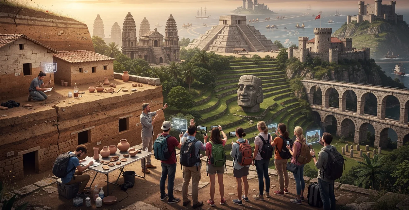
Standing before the weathered stones of ancient monuments, modern travellers encounter profound lessons that textbooks simply cannot convey. These archaeological treasures serve as tangible libraries, where each fragment tells stories of human ingenuity, cultural evolution, and civilisational achievements spanning millennia. From the precision of Roman engineering to the astronomical sophistication of Maya calendars, ancient ruins offer unparalleled insights into how our ancestors lived, worked, and understood their world.
The experience of visiting these sites transcends mere tourism; it becomes an educational journey that connects contemporary visitors with the fundamental aspects of human experience. Archaeological evidence reveals universal themes of innovation, adaptation, and cultural exchange that remain remarkably relevant today. By learning to interpret these ancient messages, travellers develop a deeper appreciation for historical continuity and the enduring nature of human creativity.
Archaeological site interpretation methods for contemporary travellers
Understanding archaeological sites requires more than casual observation; it demands familiarity with scientific methods that unlock their historical significance. Modern travellers who grasp these interpretation techniques gain exponentially richer experiences, transforming simple sightseeing into meaningful historical dialogue. The ability to read stratigraphic layers, comprehend dating methodologies, and recognise architectural patterns enables visitors to appreciate the sophisticated research underlying our knowledge of ancient civilisations.
Contemporary archaeology employs multiple complementary approaches to reconstruct past societies. These methodologies work together like pieces of a complex puzzle, each contributing essential information about ancient peoples’ daily lives, belief systems, and technological capabilities. Interdisciplinary collaboration between archaeologists, historians, and specialists in various fields creates comprehensive narratives that illuminate the past with remarkable clarity and precision.
Stratigraphy reading techniques at pompeii and herculaneum
The volcanic preservation of Pompeii and Herculaneum provides extraordinary opportunities for understanding stratigraphic analysis. These sites demonstrate how archaeological layers tell chronological stories, with each stratum representing specific moments in time. Visitors can observe how the catastrophic eruption of Mount Vesuvius in 79 CE created distinct archaeological horizons that preserve precise snapshots of Roman urban life.
Walking through these remarkably preserved cities, travellers witness stratification principles in action. The volcanic ash layers show clear temporal sequences, whilst preserved buildings display construction phases spanning centuries. This visible stratigraphy enables visitors to understand how archaeologists determine the relative ages of artefacts and reconstruct historical timelines with remarkable accuracy.
Carbon dating evidence understanding at göbekli tepe
Göbekli Tepe revolutionised our understanding of Neolithic societies through precise radiocarbon dating that placed its construction around 9600 BCE. This dating methodology provides crucial temporal anchors for understanding prehistoric development. Visitors to this Turkish site can appreciate how radiometric dating techniques revealed that complex monumental architecture preceded agricultural settlements by millennia.
The implications of Göbekli Tepe’s age challenge traditional narratives about civilisational development. Carbon dating evidence suggests that organised religion and monumental construction may have catalysed agricultural innovation, rather than resulting from it. This paradigm shift demonstrates how scientific dating methods continue reshaping our understanding of human cultural evolution and social complexity.
Ceramic typology analysis at mesa verde cliff dwellings
The Ancestral Puebloan settlements at Mesa Verde showcase how ceramic analysis reveals cultural continuity and change over centuries. Pottery sherds provide archaeologists with detailed chronological markers, as decorative styles and manufacturing techniques evolved predictably over time. Visitors can observe how ceramic typologies help establish relative dating sequences and cultural affiliations across the American Southwest.
Ceramic analysis at Mesa Verde demonstrates remarkable cultural sophistication amongst Ancestral Puebloan societies. The evolution from simple utility vessels to elaborate decorated pottery reflects increasing social complexity and artistic expression. These ceramic traditions provide insights into trade networks, cultural exchanges, and technological innovations that connected distant communities across vast geographical distances.
Architectural periodisation recognition at angkor wat complex
The Angkor complex displays clear architectural evolution spanning several centuries of Khmer construction. Understanding these stylistic periods enables visitors to appreciate the sophisticated urban planning and religious architecture that characterised this Southeast Asian empire. Each temple reflects specific
religious and political priorities, from early Hindu state temples to later Buddhist sanctuaries. By learning to recognise differences in tower shapes, bas-relief styles, and layout plans, travellers can trace how Angkor shifted from Hindu cosmology toward Mahayana and then Theravada Buddhist practice. This architectural periodisation acts like a visual timeline, allowing visitors to “read” centuries of Khmer history simply by walking from one temple complex to another.
Contemporary travellers can enhance their Angkor Wat visit by noting diagnostic features of each period. Earlier temples often feature sandstone towers with relatively simple lintel carvings, whereas later constructions, such as Bayon, display the iconic smiling faces and denser narrative reliefs. Observing how water systems, causeways, and enclosure walls changed over time also reveals evolving approaches to urban planning and royal authority. In this way, architectural periods become powerful tools for understanding how religious ideas, political power, and environmental management intersected in the Angkor landscape.
Pre-columbian civilisation insights through mesoamerican monuments
Pre-Columbian monuments across Mesoamerica function as open-air textbooks on indigenous science, political organisation, and cosmology. When we move beyond admiring their scale and beauty to interrogate how and why they were built, these sites teach us how deeply ancient peoples engaged with astronomy, agriculture, and social hierarchy. Each pyramid, plaza, and carved stela communicates aspects of timekeeping, governance, and ritual life that remain relevant to contemporary debates about sustainable living and cultural resilience.
For modern travellers, Mesoamerican ruins also challenge long-held stereotypes that pre-Hispanic societies were technologically “primitive.” Monumental architecture aligned to solstices, sophisticated urban layouts, and resilient agricultural systems reveal advanced knowledge developed independently of Old World civilisations. By approaching these sites with curiosity and respect, you gain a more nuanced understanding of American history that predates European contact by thousands of years.
Maya calendar system decipherment at chichen itza
Chichen Itza is one of the best places to see the Maya calendar system expressed in stone. The famous pyramid of Kukulcán (El Castillo) incorporates calendrical symbolism into its very structure: four stairways with 91 steps each, plus the top platform, produce 365 steps corresponding to the solar year. During the equinoxes, the late-afternoon sun casts a serpent-shaped shadow along the staircase, visually linking astronomical cycles with religious imagery. Observing this phenomenon helps travellers grasp how intimately the Maya connected celestial movements with ritual and political authority.
Interpreting the Maya calendar can feel complex at first, but site museums and local guides often provide accessible explanations. You will encounter references to the Tzolk’in (260-day ritual calendar) and the Haab’ (365-day solar calendar), as well as the Long Count system used to track longer historical cycles. Understanding that dates on stelae and temple inscriptions combine these overlapping systems enables you to appreciate how the Maya conceptualised time as cyclical rather than linear. For contemporary travellers, this alternative temporal framework offers a powerful reminder that our modern calendar is only one of many ways humans have structured their experience of history.
Aztec urban planning principles at teotihuacan
Although Teotihuacan predates the Aztec Empire by many centuries, it became central to Aztec identity and influenced later urban planning across central Mexico. Walking along the Avenue of the Dead today, visitors can see how the city was organised according to both practical and cosmological principles. The main axis aligns roughly with important celestial settings, while residential compounds, marketplaces, and temples are arranged around plazas that facilitated both commerce and ceremony. This integrated design illustrates how ancient cities could serve economic, religious, and administrative functions simultaneously.
Modern travellers can learn to “read” Teotihuacan’s layout as a blueprint for pre-Columbian urbanism. The consistent use of apartment compounds suggests a degree of social organisation that accommodated diverse occupational groups within a planned grid. Water management systems, including canals and cisterns, reveal sophisticated responses to environmental constraints. By comparing Teotihuacan’s design with contemporary megacities, we are prompted to ask: how might modern urban planners reintegrate sacred spaces, social cohesion, and sustainable infrastructure into sprawling metropolitan regions?
Inca agricultural terracing technology at machu picchu
Machu Picchu’s dramatic setting often draws attention away from its most instructive feature: the extensive system of agricultural terraces that cling to the mountainsides. These terraces are not mere visual embellishments; they represent precise engineering solutions to problems of erosion, water control, and limited arable land. Layers of gravel, sand, and fertile soil within each terrace facilitated drainage and moisture retention, allowing the Inca to cultivate crops at high altitude with remarkable efficiency.
Travellers who focus on these terraces gain insight into Inca environmental knowledge and sustainable agriculture. Researchers have documented temperature variations between upper and lower terraces, suggesting that Machu Picchu functioned as a kind of experimental agricultural station, testing which crops thrived under different microclimatic conditions. As climate change forces modern societies to reconsider farming practices, Machu Picchu’s terraces provide a powerful analogue for adaptive, low-impact agriculture in challenging environments. Observing these systems in person encourages visitors to think about how ancient engineering might inform future food security strategies.
Olmec colossal head symbolism at la venta
The Olmec site of La Venta, with its colossal stone heads, offers a window into one of Mesoamerica’s earliest complex societies. These massive sculptures, some weighing several tonnes, portray individuals with distinctive headgear and facial features, likely representing rulers or important ritual figures. Their scale alone communicates the centrality of leadership and ceremonial authority in Olmec society, while the effort required to carve and transport them testifies to significant social organisation and labour mobilisation.
Understanding the symbolism of the colossal heads helps travellers appreciate how early Mesoamerican societies articulated power and identity. Many scholars interpret the helmet-like headdresses as indicators of ballgame participation or military leadership, hinting at the political and ritual roles of depicted individuals. The deliberate burial and reorientation of some heads suggest they remained active symbols in community memory long after their initial installation. For modern visitors, these sculptures demonstrate that even in the absence of written records, iconography can preserve complex narratives about hierarchy, mythology, and social values.
Roman engineering legacy visible in mediterranean ruins
Across the Mediterranean basin, Roman ruins illustrate how engineering innovations reshaped landscapes and daily life. Aqueducts, amphitheatres, roads, and bath complexes reveal a civilisation deeply committed to infrastructure and public amenities. When you walk through these sites, you are not only seeing stone remnants; you are encountering the material legacy of standardised building techniques, legal frameworks, and logistical systems that underpinned an empire spanning three continents.
Travellers can observe Roman engineering principles in locations as varied as the Pont du Gard in France, the aqueducts of Segovia in Spain, and the Colosseum and Forum in Rome. Key technologies—such as the widespread use of concrete, the mastery of the arch and vault, and precise surveying methods—enabled large-scale construction projects that still influence modern civil engineering. Noticing details like the gradient of an aqueduct channel or the radial organisation of amphitheatre seating allows visitors to connect abstract textbook diagrams with tangible, enduring structures.
Roman ruins also demonstrate how infrastructure supported social and political control. Roads facilitated rapid troop movements and tax collection, while monumental public buildings projected imperial authority in distant provinces. Today, many European cities still follow traces of Roman street grids, and several active bridges and roads rest atop ancient foundations. For contemporary travellers, recognising these continuities underscores how past engineering decisions continue to shape present-day mobility, urban identity, and regional economies.
Medieval fortification evolution across european castles
European castles chart a clear trajectory in defensive architecture from simple hilltop fortresses to sophisticated, multi-layered strongholds. As travellers move from early motte-and-bailey sites to later stone castles, they can trace responses to changing military technologies, especially the introduction of powerful siege engines and, later, gunpowder. Each architectural adaptation—thicker walls, angled bastions, concentric enclosures—represents a negotiation between offence and defence that still informs modern security design.
Walking through these fortifications, you can see how medieval builders balanced practical concerns with symbolic messages. High keeps, imposing gatehouses, and elaborate curtain walls not only protected inhabitants but also projected lordly power across surrounding landscapes. Understanding the evolution of castle design transforms a picturesque ruin into a case study in technological innovation, social hierarchy, and regional conflict.
Norman keep architecture at tower of london
The Tower of London exemplifies early Norman keep architecture, built shortly after the 1066 conquest to assert control over a newly subdued population. The central White Tower, with its thick walls and limited external openings, was designed as both last-resort refuge and visible symbol of royal authority. Its rectangular plan, internal chapel, and multi-storey layout illustrate how keeps combined defensive and residential functions in a single massive structure.
Modern visitors can read the Tower’s architecture as a physical manifestation of political change. Positioned strategically beside the Thames and within sight of the City of London, the fortress dominated trade routes and urban life. Over subsequent centuries, additional walls, towers, and moat systems were added, reflecting evolving security concerns and royal priorities. By comparing these phases, travellers can see how a Norman stronghold gradually transformed into a complex site encompassing palace, prison, armoury, and treasury—mirroring the increasing complexity of the English state.
Concentric castle design at caerphilly castle
Caerphilly Castle in Wales showcases the development of concentric defensive design, in which multiple rings of walls and water defences create layered protection. Built in the late 13th century, the castle features massive curtain walls, gatehouses, and artificial lakes that would have significantly slowed attackers. For travellers, exploring these successive barriers is like walking through a three-dimensional diagram of medieval military theory.
Concentric design at Caerphilly illustrates how architects integrated landscape engineering with fortress construction. The expansive water defences not only hindered siege engines but also reflected the castle’s imposing silhouette, amplifying its psychological impact. Visitors who pay attention to sight lines from arrow loops, the positioning of towers for flanking fire, and controlled access routes through gatehouses can appreciate how every architectural element served a strategic purpose. These lessons in depth defence still resonate in contemporary discussions about layered security and risk management.
Crusader fortress adaptations at krak des chevaliers
Krak des Chevaliers, perched in modern-day Syria, epitomises the apex of Crusader military architecture. Expanded by the Knights Hospitaller in the 12th and 13th centuries, the fortress combines Western European design with local building traditions and responds directly to siege tactics prevalent in the Levant. Its formidable outer walls, rounded towers, and carefully engineered entrance passages demonstrate how Crusader architects learned from both their own experiences and those of regional adversaries.
Travellers who study Krak des Chevaliers can see how fortifications evolved in response to new threats, particularly powerful trebuchets and mining operations. The fortress’s sloped glacis, reinforced towers, and intricate system of inner wards reveal efforts to deflect projectiles, prevent undermining, and compartmentalise defence should outer layers fall. Observing these adaptations encourages modern visitors to think critically about how cultural encounters during the Crusades—however violent—produced architectural and technological exchanges with long-lasting consequences.
Ancient trade route documentation through archaeological evidence
Ancient trade routes often leave no written signposts, yet their paths can be reconstructed through careful archaeological detective work. Objects found far from their source—obsidian blades, Roman coins, Chinese silk fragments, or Indian beads—act like breadcrumbs scattered along former caravan tracks and maritime corridors. For contemporary travellers, recognising these clues at archaeological sites reveals how interconnected the ancient world truly was.
Examples of this connectivity abound. In the Mediterranean, amphorae stamped with workshop marks trace commercial networks that supplied olive oil and wine across the Roman Empire. Along the Silk Road, excavated textiles and imported ceramics show exchanges between Central Asia, China, and the Middle East. Even at remote desert caravanserais, travellers can sometimes see niches and storerooms that once held goods moving between Africa and the Levant. Understanding these material traces helps us appreciate that globalisation is not a modern invention but a process with deep historical roots.
As you visit ancient ruins, you can actively look for evidence of trade in site museums and interpretive panels. Ask yourself: which materials could not have originated locally? Are there stylistic elements—like particular motifs on pottery or sculptural forms—that resemble those from distant cultures? In many cases, archaeologists combine such observations with scientific analyses, such as isotope studies or petrographic examination, to pinpoint the geographic origins of objects. These methods turn scattered artefacts into compelling maps of long-vanished trade routes, reminding travellers that cultural exchange has always been central to human history.
Digital heritage preservation technologies enhancing historical understanding
Digital technologies are transforming how travellers experience ancient ruins and understand archaeological research. High-resolution 3D scanning, drone photogrammetry, and virtual reality reconstructions capture fragile sites in extraordinary detail, creating digital twins that can be explored long after physical structures have eroded. For visitors, these tools act like time machines, allowing us to visualise buildings as they once stood rather than as fragmented remains.
On-site, augmented reality (AR) applications can overlay reconstructions onto existing ruins, helping you see missing columns, roofs, and painted surfaces as you move through a site. Interactive screens in museums now display stratigraphic layers, construction phases, and object findspots in ways that were unimaginable a decade ago. Even if you are visiting from home, many institutions offer virtual tours and online 3D models that make distant monuments accessible to students and curious travellers worldwide. These digital resources broaden participation in heritage, though they also raise questions about data ownership, representation choices, and long-term storage.
For modern travellers, engaging thoughtfully with digital heritage means treating these technologies as supplements rather than replacements for physical encounters. A laser scan can preserve the exact geometry of a temple, but it cannot fully replicate the feeling of climbing its worn steps at sunrise or hearing local guides share community memories. The most rewarding approach combines both: using digital reconstructions to understand complex site histories while remaining attentive to the sensory and cultural dimensions of being there. In doing so, we honour both the scientific and humanistic sides of archaeology—and ensure that ancient ruins continue to teach us about history in ways that are meaningful, responsible, and profoundly enriching.