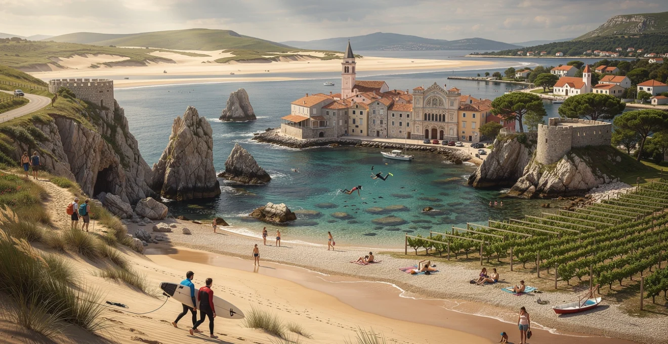
When most travellers dream of coastal escapes, their minds drift toward the familiar—the French Riviera’s glittering shores, the Caribbean’s turquoise waters, or Thailand’s island-studded seas. Yet some of the world’s most captivating coastal experiences lie hidden on peninsulas that jut into oceans and seas with distinctive character, offering beaches that range from wild Atlantic strands to sheltered Mediterranean coves. These finger-like stretches of land provide something the typical island getaway cannot: a connection to mainland culture, history, and landscape whilst maintaining the isolation and natural beauty that make beach destinations so alluring. Across continents, from Ireland’s storm-battered western edges to Croatia’s sun-drenched Adriatic coastline, peninsulas harbour secret beaches, ancient settlements, and authentic experiences far removed from overcrowded resorts. The beauty of peninsula travel lies in its versatility—you can explore dramatic coastal scenery one moment and delve into centuries-old traditions the next, all without losing sight of the sea.
Dingle peninsula’s secluded atlantic coves and gaelic heritage
Ireland’s Dingle Peninsula extends into the wild Atlantic like a rugged finger pointing toward America, its coastline carved by millennia of waves and wind into one of Europe’s most spectacular coastal landscapes. Unlike the package-holiday destinations that dominate Mediterranean shores, Dingle offers something increasingly rare: authenticity married to stunning natural beauty. The peninsula remains one of Ireland’s last Gaeltacht regions, where the Irish language still echoes through village pubs and traditional music sessions continue nightly. This cultural preservation hasn’t happened by accident—the peninsula’s relative isolation, combined with fierce local pride, has protected both its linguistic heritage and its unspoiled coastal environment. What strikes visitors most profoundly is the colour palette: emerald hillsides tumbling toward beaches of golden sand, backed by mountains that seem to rise directly from the sea, all beneath skies that shift from brilliant blue to brooding grey within moments.
Inch beach’s Four-Kilometre surfing strand and dune systems
Sweeping in a magnificent arc along the peninsula’s eastern edge, Inch Beach presents four kilometres of golden sand flanked by towering dune systems that have survived centuries of Atlantic storms. The beach gained international recognition when director David Lean chose it as a filming location for “Ryan’s Daughter,” but it remains remarkably uncommercialized—just a car park, a surf shop, and a casual café serving tea and sandwiches to wetsuit-clad surfers. The waves here offer consistent breaks suitable for beginners learning to stand on a board for the first time, whilst more experienced surfers find challenging conditions on bigger swell days. Walking the full length of Inch Beach at low tide reveals an ever-changing landscape of rippled sand patterns, tidal pools teeming with marine life, and shells deposited by the previous night’s tide. The dune systems behind the beach support rare plant species and provide vital habitat for nesting birds, making this strand not just a recreational space but an important ecological preserve.
Slea head drive’s dunquin pier and blasket islands viewpoints
The Slea Head Drive ranks among Europe’s most breathtaking coastal routes, winding along cliff edges with vertiginous drops to the crashing Atlantic below. At Dunquin, a dramatic pier zigzags down the cliff face in a series of concrete platforms that once served as the departure point for the now-abandoned Blasket Islands visible offshore. Standing at the pier, you’re confronted with the reality of island life’s harshness—the crossing, even on calm days, requires nerve and skill, and in winter storms the islands become completely cut off. The Great Blasket was finally evacuated in 1953 when the remaining population dwindled to just twenty-two people, but the island’s literary legacy lives on through autobiographies written by former residents that capture a way of life now vanished. From various viewpoints along Slea Head Drive, the Blaskets appear as sleeping giants in the ocean, their profiles changing with the light and weather. On clear days, you can distinguish individual stone walls and abandoned cottages through binoculars, ghostly reminders of communities that once thrived in what seems an impossibly harsh environment.
Ventry beach’s
crescent of soft sand arcs around one of the peninsula’s most sheltered natural harbours, protected from the full force of the Atlantic by headlands that cradle the bay. Ventry Beach is a favourite with families and open-water swimmers thanks to its calm, shallow waters and Blue Flag status, which indicates high environmental and water-quality standards. Walk west along the sand and you’ll notice low grassy ridges and stone outlines inland—subtle hints of the Bronze Age ringforts and early Christian sites that dot the surrounding hills. Archaeological surveys have revealed layers of human settlement here stretching back over three thousand years, a reminder that this apparently sleepy village once sat on an important coastal route. Today, you can combine a leisurely beach day with short hikes up to nearby viewpoints, where interpretation panels help you piece together the peninsula’s long story of farmers, fishermen and monastic communities living at the edge of Europe.
Coumeenole beach’s dramatic sea stacks and coastal hiking routes
Tucked beneath sheer cliffs near the westernmost tip of the Dingle Peninsula, Coumeenole Beach feels like a natural amphitheatre where Atlantic swells take centre stage. The small, sandy cove is framed by jagged sea stacks and rock formations carved over millennia, creating an otherworldly landscape that has appeared in films and countless photography portfolios. Swimming here can be dangerous due to strong currents and unpredictable waves, so Coumeenole is best appreciated as a place to walk, watch the surf and explore rock pools rather than to bathe. Above the beach, the cliff-top path forms part of longer coastal hiking routes that link viewpoints along Slea Head, allowing you to trace the contours of the peninsula on foot. On clear days, the Blasket Islands seem almost within touching distance, and you can understand why writers have described this stretch of coast as “the last parish before America.”
Istria peninsula’s adriatic shoreline and venetian coastal towns
Shaped like an upside-down heart at the northern end of the Adriatic, Croatia’s Istria Peninsula blends Mediterranean beaches with layers of Roman, Venetian and Austro-Hungarian history. Unlike the more famous Dalmatian islands, Istria offers an easy combination of shoreline relaxation and inland exploration, with hilltop towns, vineyards and truffle-rich forests just a short drive from the sea. The coastline alternates between rocky coves, pebble beaches and rare sandy patches, many of them backed by pine woodland that provides natural shade in the height of summer. Italian place names, pastel-coloured harbours and campanile towers betray centuries of Venetian rule, while café terraces hum with conversations in both Croatian and Italian. For travellers seeking an Adriatic destination with characterful towns and a slightly slower pace than Croatia’s headline hotspots, Istria’s peninsulas and bays deliver a compelling mix.
Kamenjak national park’s untouched bays and snorkelling spots
At the very southern tip of Istria, the Kamenjak Peninsula juts into the Adriatic as a protected landscape of limestone headlands, maquis shrub and secluded inlets. Designated as a nature park, Kamenjak has largely escaped large-scale development, so access is still via dusty tracks that lead to hidden bays where the water turns from emerald to inky blue within a few metres. Here, you’ll find some of Istria’s best snorkelling spots, with rocky seabeds that support sea urchins, anemones and shoals of small fish visible just below the surface. Many visitors choose to explore by bicycle, using marked trails that loop around the peninsula and descend to beaches with simple wooden jetties and seasonal beach bars perched on cliffs. Because mobile coverage can be patchy and signage minimal, it pays to download an offline map and carry plenty of water—part of Kamenjak’s appeal lies in its sense of remoteness, even though it sits a short drive from Pula.
Rovinj’s pebble beaches and austro-hungarian architectural quarter
Rovinj curls around a small peninsula crowned by the baroque Church of St. Euphemia, its bell tower a near-twin of Venice’s campanile across the Adriatic. At street level, the Old Town’s narrow alleys tumble directly to the water, where swimmers slip into the sea from polished stone ledges and small pebble coves. South of the historic centre, a string of beaches—such as Lone Bay and Cuvi Beach—offer a more conventional seaside experience, with pine trees leaning over clear shallows ideal for stand-up paddling and relaxed swims. The town’s built fabric tells a different story, with pastel façades, wrought-iron balconies and faded Austro-Hungarian townhouses reflecting a period when Rovinj was one of the empire’s important ports. For visitors, this means you can spend your morning exploring cobbled streets and art studios, your afternoon on the beach, and your evening dining on seafood risotto beneath Venetian-style windows that glow in the sunset.
Poreč’s lanterna beach complex and unesco euphrasian basilica
Further up the Istrian coast, Poreč blends resort-style beaches with an historic core centred on the UNESCO-listed Euphrasian Basilica. Just north of town, the Lanterna Peninsula forms a semi-enclosed world of pine groves, pebble coves and designated swimming zones that cater to families, snorkellers and water-sports enthusiasts alike. While some areas feature sunbeds and beach bars, you can still find quieter rocky outcrops where locals escape with a towel and a book, taking advantage of the peninsula’s varied coastline. Back in the centre, the 6th-century basilica complex offers a striking contrast to the easy-going beach scene, its glittering mosaics considered among the finest surviving examples of early Byzantine art in the Mediterranean. Combining both in a single day—climbing the bell tower for a view of the sea before cooling off at Lanterna’s beaches—highlights why Poreč remains popular with travellers who want both cultural depth and seaside relaxation.
Medulin’s bijeca sandy shore and roman villa rustica remains
On a peninsula south of Pula, Medulin has evolved from a fishing village into a low-key resort centred on the rare sandy curve of Bijeca Beach. Stretching for about a kilometre, Bijeca’s shallow, gently shelving waters make it particularly attractive for families with young children and for less confident swimmers seeking a calm Adriatic beach. Behind the sand, shaded areas and simple cafés provide respite from the sun, while pedalos and kayaks can be hired for short paddles around the bay. Yet even here, history lies just beneath the surface: archaeological excavations in and around Medulin have revealed remains of a Roman villa rustica—a countryside estate with farm buildings and mosaic floors that once overlooked the same waters. Information boards around the harbour help you imagine vineyards and olive groves supplying distant markets, underscoring how the Istria Peninsula’s beach destinations have been interwoven with Mediterranean trade and agriculture for two millennia.
Miramichi peninsula’s gulf of st. lawrence beaches and acadian culture
On Canada’s Atlantic seaboard, New Brunswick’s Miramichi Peninsula reaches into the Gulf of St. Lawrence with long sandbars, dune-backed beaches and working fishing communities steeped in Acadian and Mi’kmaq heritage. Unlike the more touristed shores of Nova Scotia’s South Shore or Prince Edward Island, Miramichi remains under the radar for many international travellers, which means quieter beaches and a more local rhythm. Places like Escuminac Beach and the dunes of Portage Island National Wildlife Area offer broad, pale sands where you can walk for kilometres with only seabirds and fishing boats for company. Water temperatures in summer are milder than you might expect at this latitude, thanks to the relatively shallow gulf, making July and August surprisingly pleasant for swimming on calm days. Inland, the Miramichi River is renowned for salmon fishing and canoe trips, so you can easily combine coastal days with time on the region’s forest-fringed waterways.
Cultural life on the peninsula reflects a resilient Acadian community that has rebuilt itself after centuries of upheaval, including the 18th-century expulsions known as the Great Upheaval. Bilingual signage, community festivals and family-run seafood shacks speak to this deep-rooted identity, with traditional music and cuisine still central to local gatherings. If you visit in late summer, you may encounter events linked to the Acadian festivals that animate nearby towns, where flags in blue, white, red and yellow fly from porches. Practicalities are straightforward but require some planning: public transport is limited, so a car is essential if you want to hop between beaches and villages at your own pace. For travellers who enjoy destinations where tourism has not yet eclipsed everyday life, the Miramichi Peninsula offers an appealing mix of wild shoreline, warm hospitality and living maritime culture.
Pelješac peninsula’s dalmatian coast and wine-growing terroir
Stretching like a long, mountainous arm into the Adriatic north of Dubrovnik, Croatia’s Pelješac Peninsula pairs dramatic coastal scenery with some of the country’s most celebrated wine-growing slopes. The interior ridge runs like a spine along the peninsula, dropping steeply to a coastline dotted with pebble beaches, fishing villages and sheltered bays that see far fewer visitors than the nearby Elaphiti Islands. Centuries of seafaring and viticulture have shaped the local economy; terraced vineyards cling to sun-baked hillsides, while small ports once launched ships that traded across the Mediterranean. Today, travellers come to Pelješac for a slower, more rural alternative to Croatia’s busier coastal hubs, drawn by the combination of crystal-clear swimming waters, hiking opportunities and cellar-door wine tastings. Road improvements, including the opening of the Pelješac Bridge in 2022, have made access easier while still preserving the peninsula’s off-the-beaten-path atmosphere.
Prapratno beach’s pine-fringed cove and byzantine fortifications
On the southern shore near the town of Ston, Prapratno Beach nestles in a deep, horseshoe-shaped bay edged with fragrant pine forest. Soft sand—still a rarity along much of the Croatian coast—slopes gently into translucent turquoise water, creating ideal conditions for families and casual swimmers. The surrounding campsite remains relatively low-rise and shaded, so the cove retains a natural feel despite its popularity with those in the know. Above the beach, hiking paths climb through woodland to viewpoints where you can see remains of Byzantine-era fortifications and, further east, the imposing stone walls of Ston snaking across the hillside. Combining a morning swim at Prapratno with an afternoon exploring Ston’s defensive architecture and famed oyster beds gives you a taste of how Pelješac’s beaches and historic sites sit side by side.
Dingač vineyard slopes and žuljana’s pebble bay swimming waters
Further west, the south-facing Dingač slopes rise steeply from the sea, forming one of Croatia’s most distinctive viticultural landscapes. Here, vines of the Plavac Mali grape grow on gradients that can exceed 45 degrees, their roots delving deep into thin, rocky soils that reflect and store the sun’s heat. This combination of terrain, exposure and proximity to the sea has created a microclimate prized by winemakers, and visiting local cellars to taste robust, dark-fruited Dingač wines is a highlight for many travellers. A narrow tunnel links the vineyard-clad southern flank to the quieter northern side of the peninsula, where the village of Žuljana curves around a wide pebble bay. The beach here offers some of the peninsula’s clearest, calmest waters, ideal for long swims, kayaking and snorkelling along rocky headlands. It’s easy to spend a day moving between these complementary experiences: rugged hillside vineyards in the morning, followed by lazy hours in Žuljana’s luminous bay.
Trpanj’s secluded beaches and franciscan monastery heritage
On the northern shore facing the mainland, Trpanj combines the feel of a sleepy harbour town with access to a string of small, secluded beaches within walking distance. While car ferries connect Trpanj to Ploče, many visitors find that once they arrive, there’s little desire to move on quickly. Paths lead from the waterfront to hidden coves such as Blace and Jezero, where smooth white pebbles and shallow, glassy water create perfect conditions for unhurried sea bathing. Above the town, the remains of a Franciscan monastery and its chapel testify to Pelješac’s religious history, when monastic communities cultivated olive groves and vineyards on the surrounding slopes. Today, you can follow signposted trails up to these ruins for panoramic views across the Adriatic and back along the peninsula, appreciating how Trpanj’s beaches, heritage and hillside landscapes intertwine in a compact, easily explored corner of the Dalmatian coast.
Kola peninsula’s barents sea coastline and arctic tundra landscapes
Jutting into the Barents and White Seas in Russia’s far northwest, the Kola Peninsula offers a starkly beautiful alternative to typical sun-and-sand escapes. Here, the appeal lies not in palm trees and cocktails but in Arctic tundra landscapes, midnight sun in summer and the Northern Lights that dance across the sky from late autumn to early spring. The coastline is rugged and sparsely populated, with rocky bays, pebble beaches and fishing settlements shaped by subarctic conditions and centuries of Pomor maritime tradition. In recent years, interest in Arctic tourism and adventure travel has grown, and the Kola Peninsula has emerged as a destination for those seeking off-the-grid hiking, river rafting and aurora photography. Travel logistics can be complex, with restricted military areas and limited public transport, so most visitors join specialist tours based out of Murmansk, the region’s main city and port.
Nature dominates daily life on Kola in a way that can feel almost humbling. Inland, low, rolling hills are carpeted with lichens, dwarf birch and moss, punctuated by countless lakes and fast-flowing rivers that are rich in salmon and trout. The short summer brings a burst of colour as wildflowers bloom and migratory birds crowd coastal wetlands, making June and July prime months for trekking and wildlife watching. Remote sandy or shingle beaches along the Barents Sea may be too cold for conventional swimming, but they provide unforgettable settings for coastal walks where you might see reindeer tracks in the sand or driftwood washed up from distant shores. For well-prepared travellers with a taste for isolation and raw landscapes, the Kola Peninsula’s combination of tundra, sea and sky offers a kind of coastal experience that feels closer to an expedition than a holiday.
Mornington peninsula’s port phillip bay bathing boxes and coastal bushland
South of Melbourne, Australia’s Mornington Peninsula curves between Port Phillip Bay and the open waters of Bass Strait, delivering a diverse coastal experience within easy reach of a major city. The inner-bay side is dotted with iconic, brightly painted bathing boxes and family-friendly beaches where the water laps gently at golden sand. Cross the peninsula and the character changes dramatically: wild surf beaches, rugged cliffs and coastal bushland dominate the ocean-facing side. This dual personality makes Mornington particularly appealing for short breaks; you can spend your morning in sheltered shallows and your afternoon watching surfers tackle ocean swells, all without driving more than an hour. Add in cool-climate wineries, hot springs and heritage townships, and the peninsula becomes far more than a simple beach escape.
Portsea back beach’s ocean surf conditions and historic quarantine station
Near the tip of the peninsula, Portsea Back Beach showcases the raw power of the Southern Ocean, its wide stretch of sand pounded by consistent surf that attracts experienced board riders and body-surfers. Strong rips and shifting sandbanks mean this is a place to respect the conditions; swimming is safest between the flags when lifesavers are on duty, and checking local surf reports before you visit is advisable. Dramatic sandstone cliffs and dune systems back the beach, with walking tracks leading to viewpoints where you can watch waves detonating against offshore reefs. Just around the corner on the calmer bay side, the historic Quarantine Station at Point Nepean tells a very different story. Established in the 1850s to process new arrivals and protect the colony from infectious diseases, its preserved buildings and interpretive displays reveal how this narrow neck of land served as Victoria’s maritime gateway long before it became a leisure destination.
Flinders’ sheltered swimming beaches and mornington peninsula national park trails
On the peninsula’s southern flank, the village of Flinders sits between the calmer waters of Western Port and the swells of Bass Strait, giving visitors a choice of beaches within a few minutes’ drive. Flinders Pier and the nearby sheltered coves are popular with swimmers, snorkellers and divers, who come to see weedy sea dragons—a spectacular, leaf-like fish species endemic to southern Australia—among the pylons. At low tide, rock platforms along the shore reveal intricate pools teeming with starfish, crabs and anemones, providing natural “aquariums” ideal for curious children and photographers alike. Above the coastline, sections of Mornington Peninsula National Park protect coastal heath and woodland, with walking trails such as the Bushrangers Bay Track offering clifftop views, kangaroo sightings and seasonal wildflowers. Planning a day that combines an early hike with an afternoon swim lets you experience both the peninsula’s bushland tranquillity and its intimate, small-scale beaches.
Sorrento’s limestone cliffs and colonial-era settlement architecture
Closer to the bay entrance, Sorrento blends scenic limestone cliffs and calm beaches with one of Victoria’s earliest European settlement sites. The town’s historic core features wide streets lined with 19th-century limestone buildings that now house cafés, galleries and boutique shops, many of them retaining original façades, verandas and wrought-iron details. A short walk away, sheltered Sorrento Foreshore Beach offers safe swimming and paddleboarding in clear, shallow water, overlooked by rows of heritage bathing boxes that add splashes of colour to the scene. For a different perspective, the cliff-top Millionaires’ Walk—part of the longer Sorrento-Portsea Artists Trail—follows a public easement behind grand homes, opening up sweeping views across Port Phillip Bay towards the distant Melbourne skyline. Standing here, you can see why artists and holidaymakers alike have been drawn to this corner of the Mornington Peninsula for over a century: it is a place where coastal beauty, architectural character and layers of local history sit comfortably side by side.